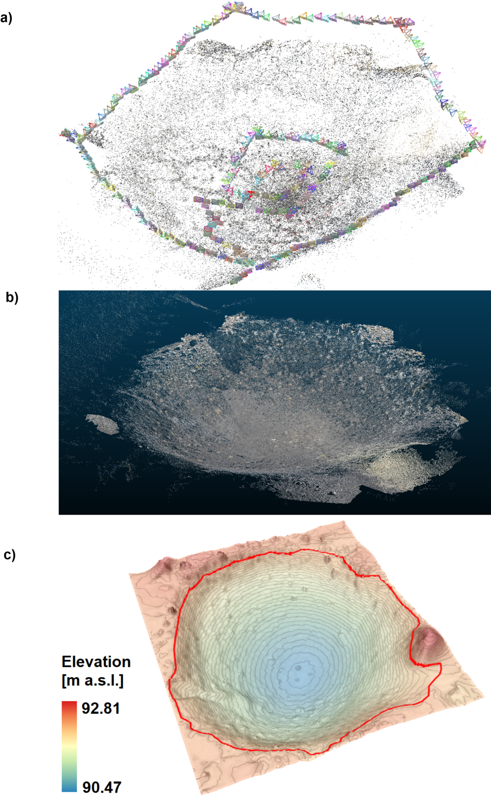
SfM technique used: a) the location of individual film frames to the landform against the background of the point cloud, b) scaled point cloud of the kettle hole with land cover, c) a digital terrain model in 3D view, resolution 0.1 m × 0.1 m, vertical exaggeration 1.5, kettle hole diameter 12 m; author: J. Szafraniec
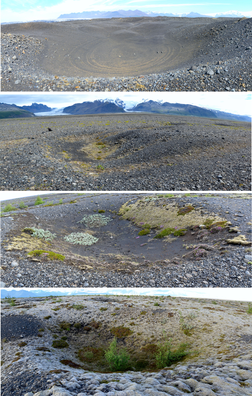
Examples of a kettle holes on Skeiðarársandur with different age and varying degrees of vegetation coverage (Photo: J. Szafraniec)
As part of the individual scientific activity of Dr Joanna E. Szafraniec and thanks to the support of the Center for Polar Studies, a research trip to Iceland took place at the end of June 2021, to the forefield of the Skeiðarárjökull glacier. The expedition aimed to set up a network of measuring points located in kettle holes. The local outwash plain is dotted with these landforms. They were formed after catastrophic glacial floods (jökulhlaup).
The results of the observations will be used to calculate the sedimentation rate and the role of plant succession in this process. Moreover, the research results will be used in the analysis of similar forms occurring in the Polish Lowlands. The established morphometric relations and the calculated sedimentation rate will allow us to determine the Polish landforms’ age and to present the scenario of Poland’s deglaciation at the end of the Pleistocene, i.e. under conditions of significant climate changes. The photogrammetric Structure from Motion (SfM) technique was also tested during the field studies to obtain a high-resolution digital elevation model of the tested landforms.
Filming permission courtesy of Vatnajökull National Park.